Planning the next leg of the Desert Trail has been a particular challenge this year. Last year I left off where Sheep Canyon empties into Badwater Basin, near the southern end of Death Valley National Park.
From there, the DT crosses, the playa, skirts the west side of Badwater Basin, passes through Stovepipe Wells, then edges west into the Cottonwood Mountains, where it turns north following the mountains through the Last Chance Range and thence out of the park and out of California and in to Nevada.
As you may know, there’s not much water in Death Valley, so this route requires several caches. That’s OK.
But the flooding last summer washed out a number of the roads that I needed to set caches along the route. Following the “official” DT route would require water carries of 50 miles and more — 12-15L. Not really up for that.
But there is nothing particularly sacred about the canonical DT route, as so few people hike it anyway. It’s just a route that works to get you north through the Mojave. It is not the only possible pathway.
So I spent the winter plotting out a more-plausible route that would not require such heinous water carries. I’d hoped to incorporate the Saline Valley Hot Springs into a route, but I could not sketch one out that did not 1) require a 50-mile water carry and 2) traverse some very rugged country that could be slow going.
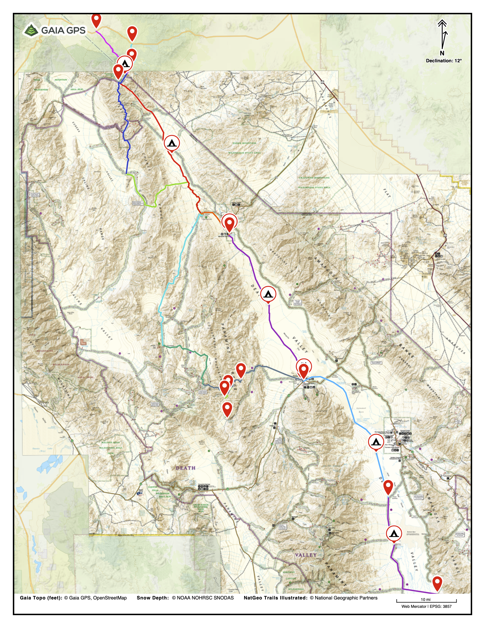
I started at the lower right and stayed on the Valley floor all the way into Nevada. The DT proper swings west into the Cottonwood Mountains (center) and then back again to the valley at Ubehebe Crater. It then swings west again through the Last Chance Mountains (top).
In the end, I decided to just stick to the Valley floor, and follow it up all the way north into the Nevada mountains. That plan made for a route that was conceptually interesting (walk the length of Death Valley) and logistically feasible (water carries 25-35 miles). I could water up at Stovepipe Wells, Mesquite Springs CG, then Willow Spring in the Sylvania Mountains near the NV border.
That left just one waterless stretch at the southern end of the route. I cached water along the Westside Rd about 30 miles south of Stovepipe.
Since I expected to take 9-10 days to cover the route, I was hoping to leave a resupply box at the Ranger Station in Stovepipe. But the rangers declined, saying that the station was understaffed and not open most days. They suggested the general store, but that was a mob scene (I think it was CA spring break). So I just went out back of the ranger station, dug a hole in the sand, dropped my resupply box in, covered it and hoped the local coyotes did not discover it before I returned.
That left me a bit of time for exploring the Park. Floods had washed out the pupfish exhibit on Salt Creek and the road to it was closed. But it was only a 1-mile walk and I longed to see some pupfish in their native habitat.
The creek was flowing strongly, and pupfish were everywhere, darting over the sandy bottom in schools of a 10-20.
Click here to see frolicking pupfish
The pupfish themselves are not very impressive. What’s impressive is that they exist where they do. As you can see from the video above, they basically live in water flowing over a sand dune. What could they possibly eat? And where do they go when it gets much hotter and much drier? Those are some tough little fish. They have my absolute respect and admiration.
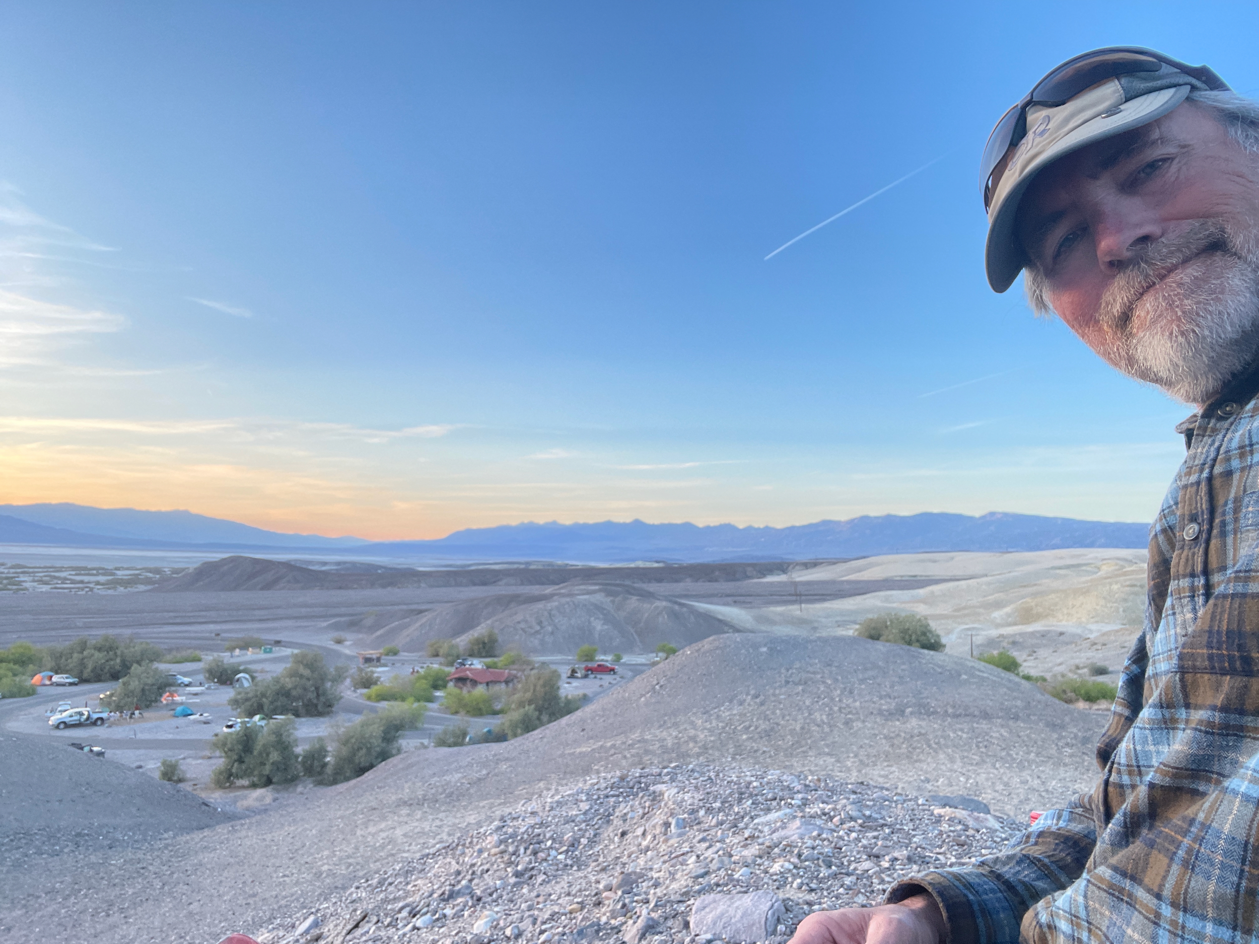
After hiking back I stopped in at the Furnace Creek bar for a beer (Furnace Creek is overrun with wealthy tourists and is kind of gross), then went back to the Texas Springs CG where I had pitched my tarp earlier.
Texas Springs is a pretty nice campground (no generators allowed). I grabbed a beer and my ukulele and climbed up on a hill overlooking the Valley for a very pleasant sunset.