

My camp last night was on the edge of the Valjean Dunes area. I stopped a little early because dunes make for poor camping. Dunes are formed by the wind and it is wind that makes their shapes interesting and attractive. Not a problem for day trips. But nights spent on dunes are not so fun. The wind will be blowing and you can’t really stake out a tent to get out of the wind. The result is a gritty, annoying night, one where you wake up often to rinse sand out of your mouth and nose and eyes. That pretty much kills the romance of camping on the dunes for me.
Early morning on the Valjean Dunes
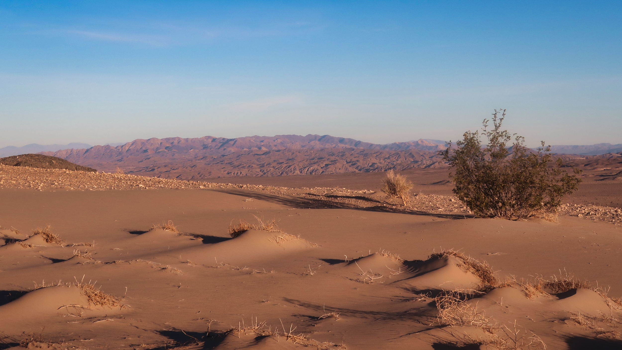
The Valjean Dunes do have some remarkable shapes, and I stopped often to admire them in the low morning sun. The footing was soft and slow which would not have been a problem except it was hot and I started drinking a lot more water than I expected.
A shapely dune
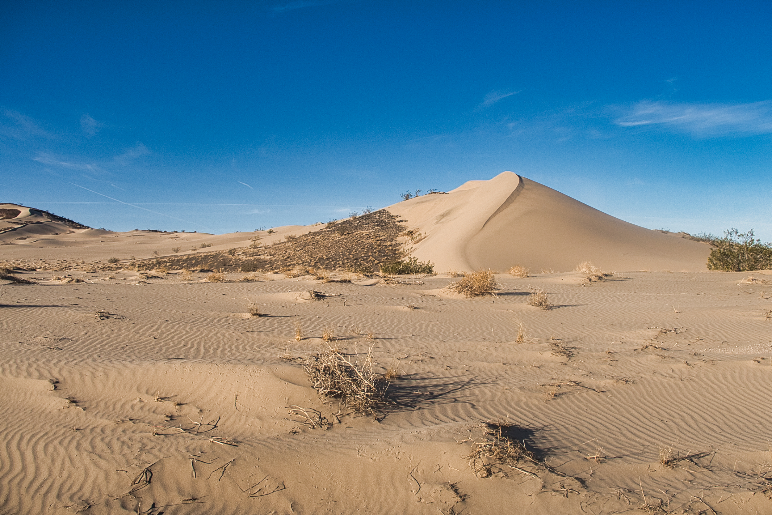
I continued dropping down in elevation as the route approaches the mouth of Amargosa Canyon. The condition of the vegetation dropped as well. Here and there were a few 100-acre patches where the creosotes were green. For the most part, the plant life was dead and brown, or else wholly absent, nothing but bare soft sandy ground.
Trekking the sandy barrens
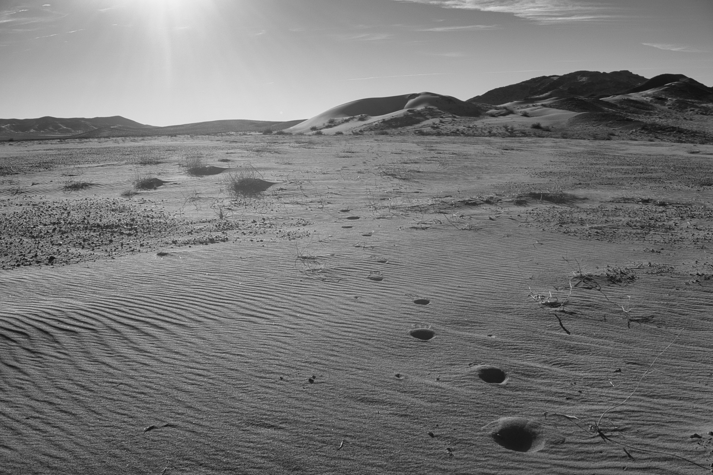
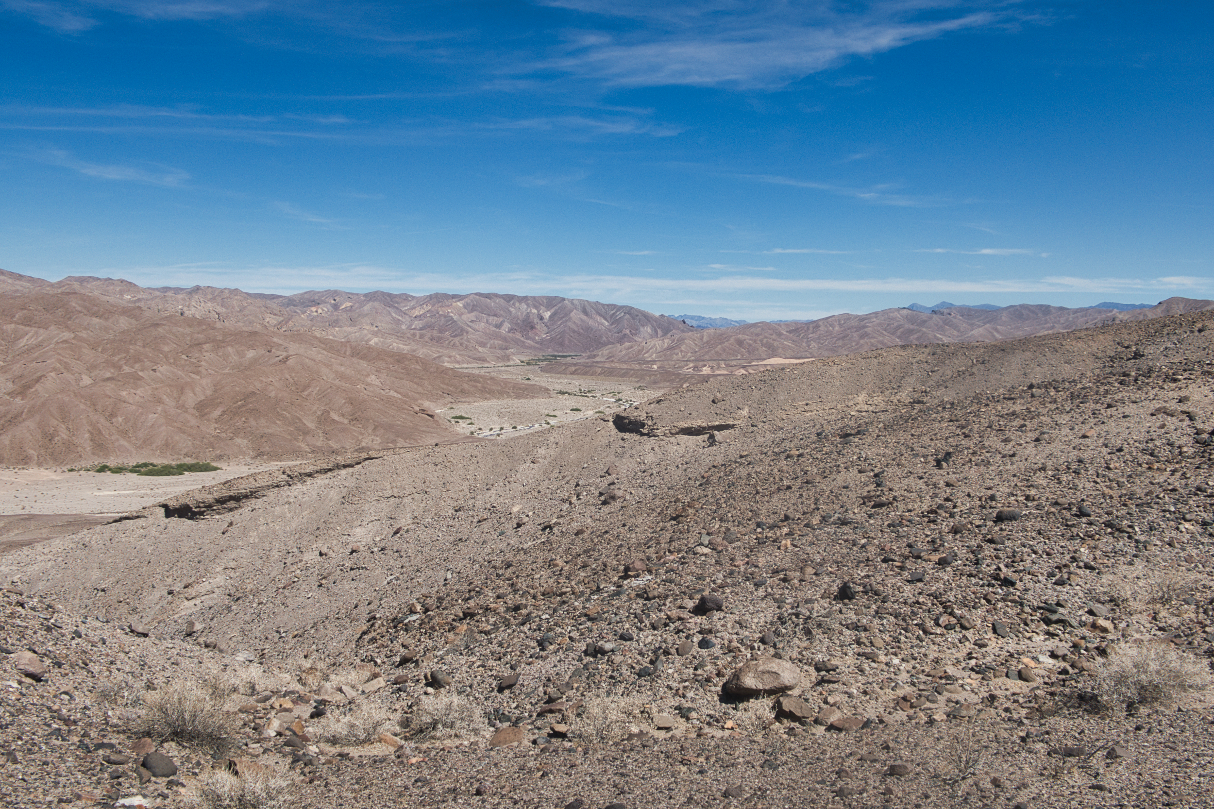
The last few miles of the valley abut the border of a designated OHV area. Much to my surprise, the cables and fences marking the border were intact. There were only a few rogue tracks crossing over into the wilderness area.
Looking across the Valjean Valley
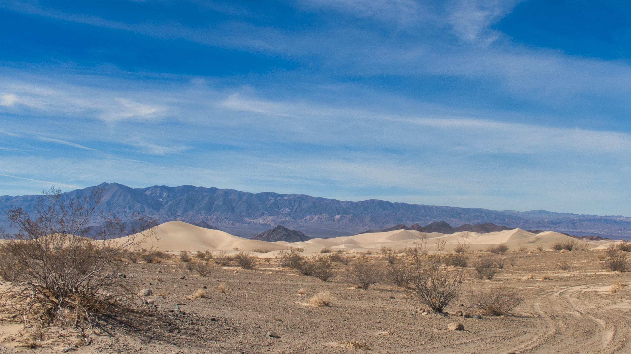
The OHV border is defined by an old railroad bed, one that I will be following all the way up the canyon to Tecopa. It tracks west along the north side of the OHV area, then finally swings north into Amargosa Canyon.
Unfortunately I mistook a jeep road for the RR bed and hiked about a mile up the rim of the canyon before my mistake became obvious. I couldn’t see a safe way down the steep canyon walls, so hiked back down the road and into the canyon proper.
In to the Amargosa Canyon
It is a strange place. The canyon bottom is wide and flat and devoid of vegetation–but sure enough, there is a small river flowing through it. Even though this area has been especially droughty in the context of the Western Megadrought, the water still flows.
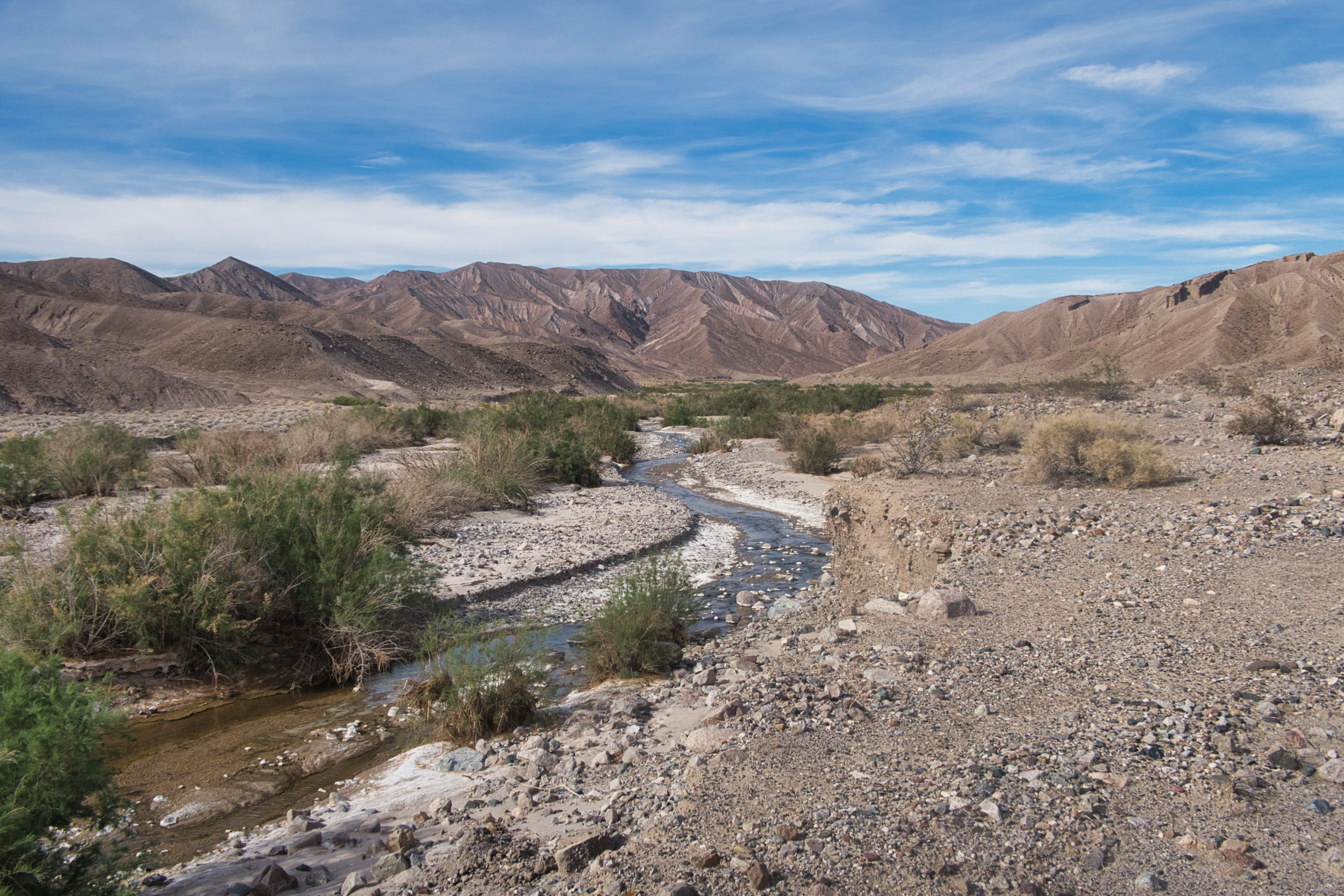
The only free-flowing river in the Mojave Desert
How drinkable that water would be was another matter. What economic activity there has been historically in this area has mostly been centered around mining alkaline mineral deposits. The train track I am following was built to haul out borax. The likelihood that the water will be salty and undrinkable is pretty high.
On the other hand, accounts of other DT hikers indicate that the water is good. I am banking on “good”–I did not put enough water in my last cache to make it to Tecopa. I will be drinking this water if it is at all drinkable, or suffer the consequences if it is not.
Vegetation in the form of tamarisks began to appear along the river. It was mid-afternoon and the thought of lolling in the shade next to a cool stream was very appealing. I cut down from the RR bed, crossed the flats, found a shady spot (after checking for snakes), dropped my pack and then scooped up some water with my hands.
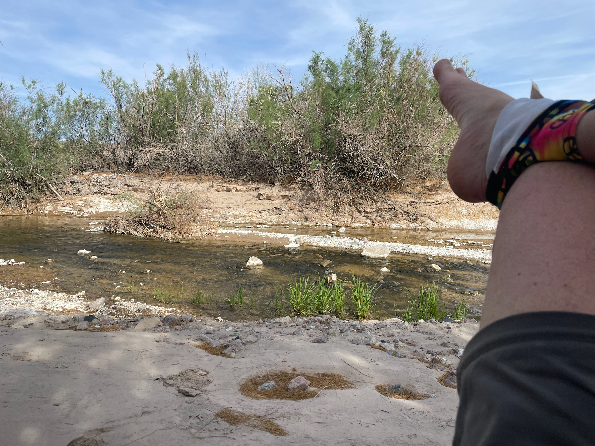
A spot of shade and a flowing river in the desert. Sounds like a good deal – but note the salty deposits on the stream banks.
It was drinkable, but just barely. It was both salty and sulfury, not at all appealing or refreshing. Not so salty that I would make myself more thirsty by drinking it. But I would have to drink a lot to net out the water:salt ratio.
I tried adding some honey ginger crystals I brought for just this purpose, and that helped a lot.
At first.
After a while, the honey sweetness combined with the sulfur to create a truly nasty flavor. I could only drink by holding my nose, glugging down as much as I could without taking a breath, and then trying not to gag it back up.
My hope was that the water was more salty at this lower end of the canyon due to evaporation and picking up more minerals as it flowed across the floor. Maybe the water would get better as I went upstream.
It did, but not by much. Steeling myself to drink enough water to stave off dehydration was a challenge.
But the walking was fairly reasonable. I alternated between the river bed and the RR bed. The latter featured numerous washouts where side canyons swept away the bed. These necessitated steep climbs down and then up crumbly embankments. The riverbed was easier for a while, but then began to fill up more with tamarisks and mesquites, making the RR bed the easier choice.
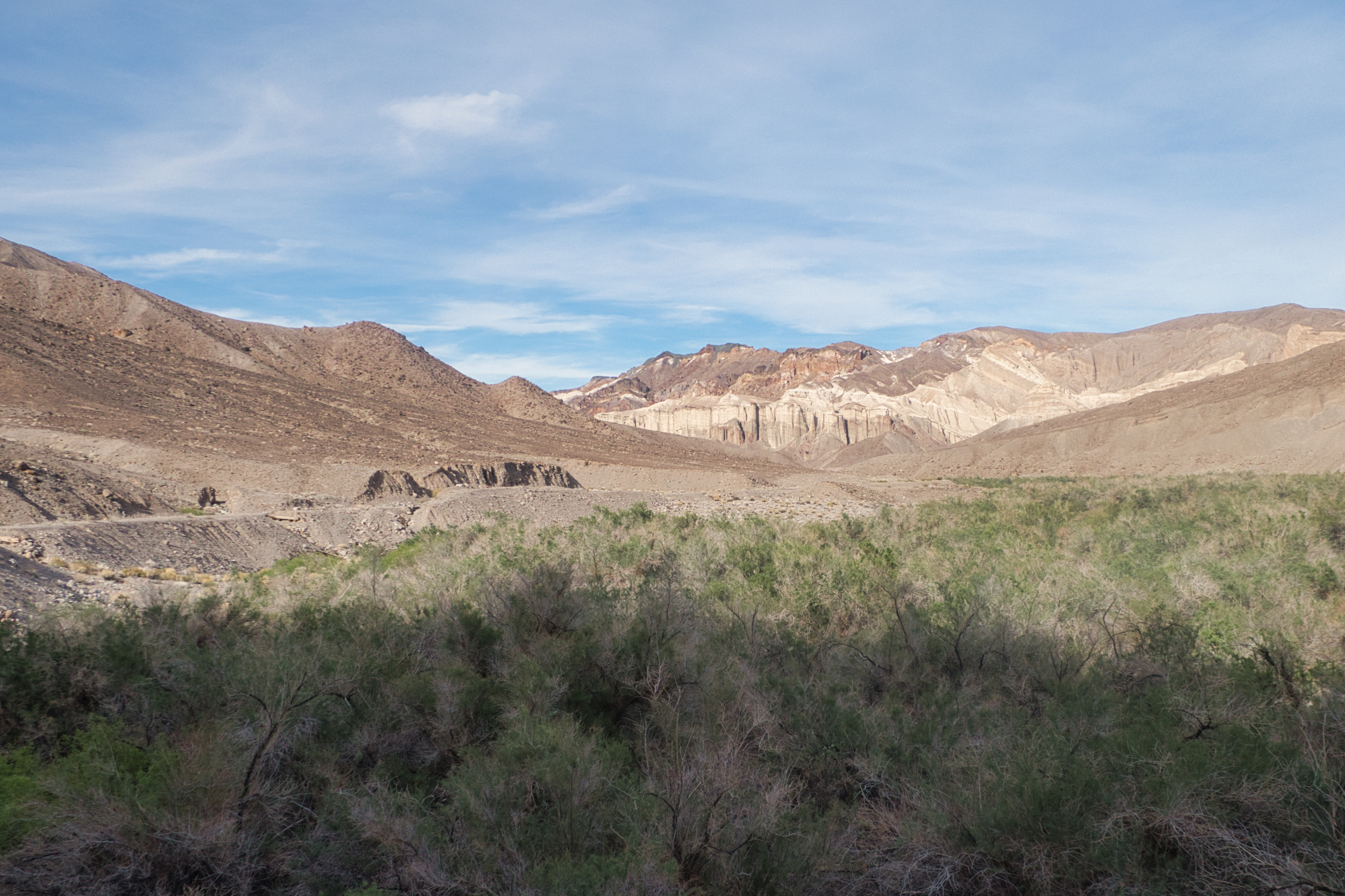
Nearing the Pinnacles, the canyon became choked with tamarisks and mesquites
I called it quits for the night where the trail crosses over the canyon and the river was choked with reeds. I reasoned that the water might be a little sweeter after flowing through a reed bed, and it was, although I would not call it palatable. But it was enough to get by with, and sometimes that just has to do.