
Despite the abundant snow I slept warmly- albeit with all my clothes and layers on. I didn’t wait around for the sun, but got moving at first light, still fully layered.
In no time at all I was at the Nevada state line. Like most state lines in the west, its location is meaningless. Congress ignored John Wesley Powell’s recommendation to have political boundaries follow watershed boundaries. This would not only be sensible, but would save a lot of inter-state conflict over water rights. Instead we got a lot of straight lines that divide mountain ranges, biomes, watersheds and people in an arbitrary and dysfunctional manner.
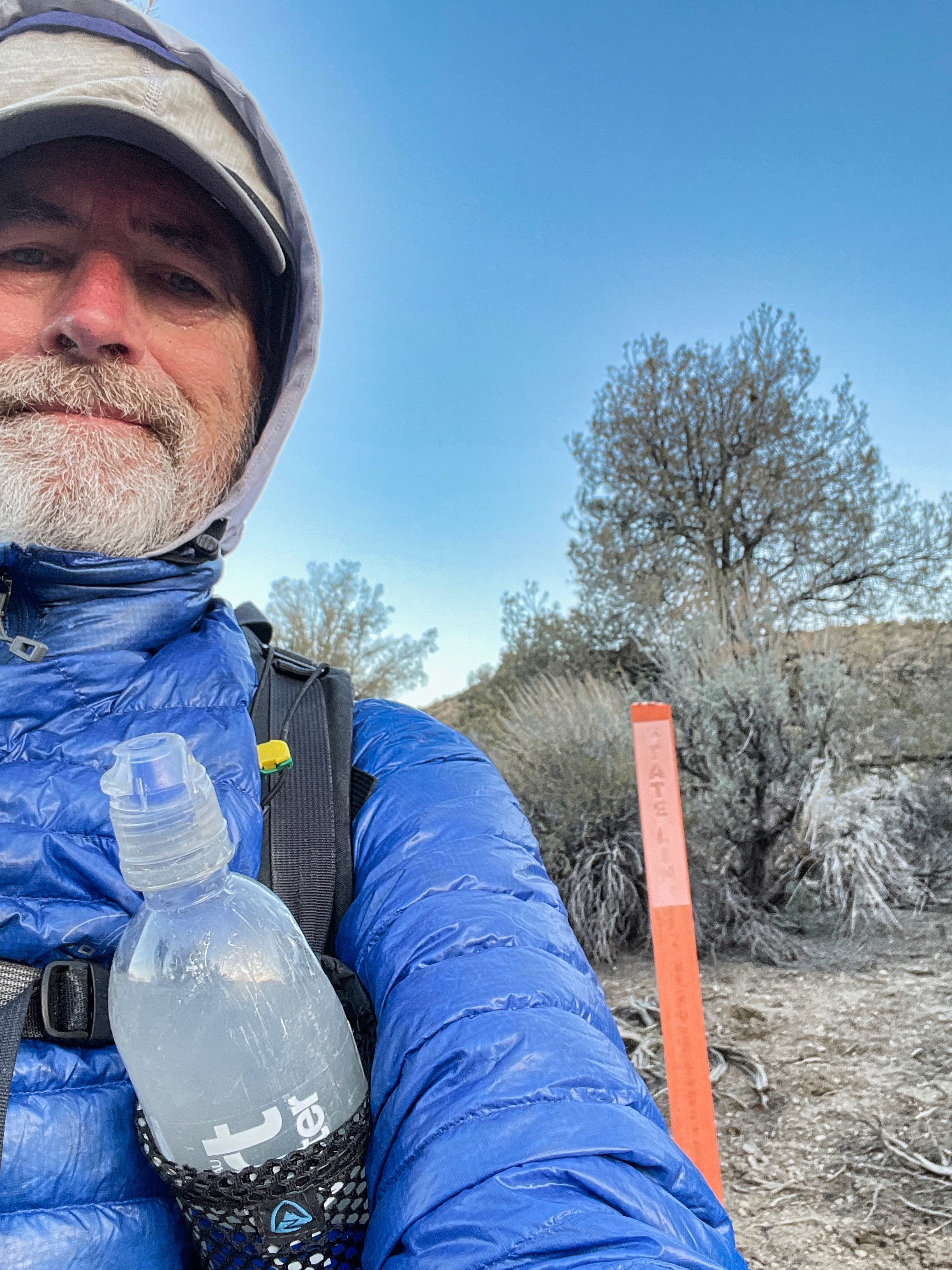
Into Nevada
Yet the boundary meant something to me. I had walked the California desert from Mexico (another arbitrary line) to Nevada over the last few years. The north end of Death Valley is the north end of the Mojave Desert. So I rightly felt that I had walked the entire Mojave, north to south. That’s a pretty good bit of walking.
It is a challenging walk for sure. There is very little trail, very little water, very few people. Space and light, rocks and sand are all that is in abundance. And catclaws.
I did see a couple of catclaws in Death Valley Wash, but I think I finally met my goal of hiking far enough north to leave them behind. I bequeathed them a fair amount of blood and skin as a legacy. I hope they use it to grow mistletoe which will then feed the phainopeplas, one of my favorite bird companions on this hike.
These birds are scarce. That abundance of rock and sand and wind equally denotes a scarcity of life. One of the gifts of the desert is to smack you with an awareness of just how implausible and wonderful life really is. Death Valley is the epitome of this teaching, a place where you don’t have to imagine what a lifeless planet would look like.
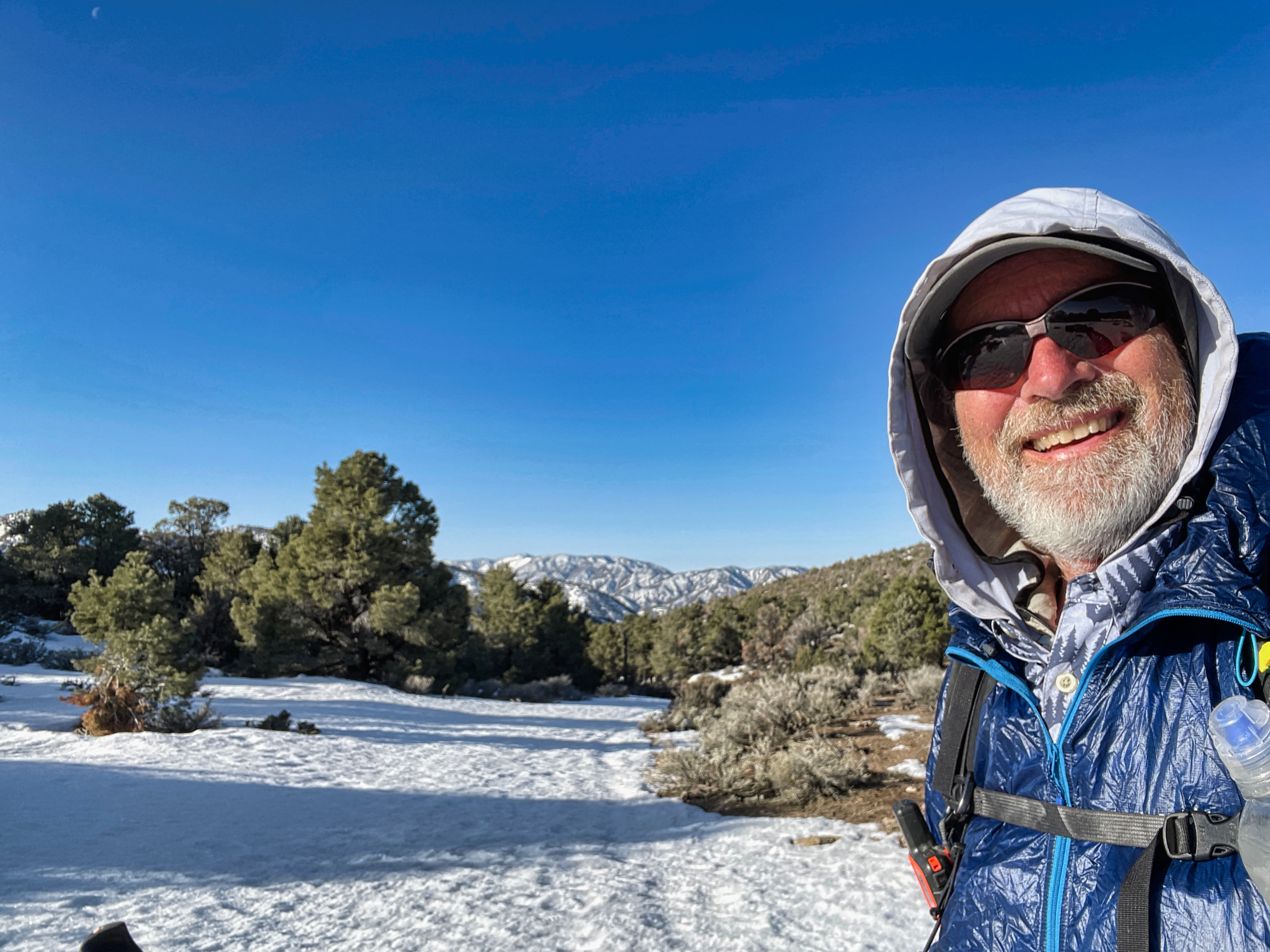
It was still pretty cold, even hiking uphill. The cold didn’t bother me. The uphill part did. Not because I hate climbing–that’s just a part of hiking–but because the snow was getting deep. It went from patches to solid to several feet deep by the time I hit the 7000 foot level. That was the point where the DT leaves the road to strike west cross-country and climb another 1000 feet before dropping down to the highway.
My snowy exit
This seemed undesirable. It was not difficult to visualize myself floundering knee- or hip-deep in a well-shaded gully on the north side of the mountain.
The map showed that I could continue on the road north, start dropping down soon, then hit the highway in 5-6 miles, a much better route. A possible drawback was the private land inholding at the bottom of the gulch. It was a long rectangle, indicative of an old mining claim. With luck it would be abandoned and I could just walk through unmolested. Without luck it would be occupied by hostile armed citizens of Bundy-land.
The amount of snow was so much more than I expected. It was deep all the way down to the 6000 foot level, and I ended up walking 3-4 miles on snow all told. Fortunately it was consolidated and frozen so made a good walking surface.
The upper half of the inholding contained a couple of abandoned mines, so that was well and good.
The bottom half contained a dozen cabins and trailers, a couple of which had what appeared to be functional vehicles in front of them. It was still early, no one was out. I kept to what cover I could and slinked down the road quickly. No one came out to hassle me or draw on me. So score one for the State of Nevada over the State of Jefferson.