

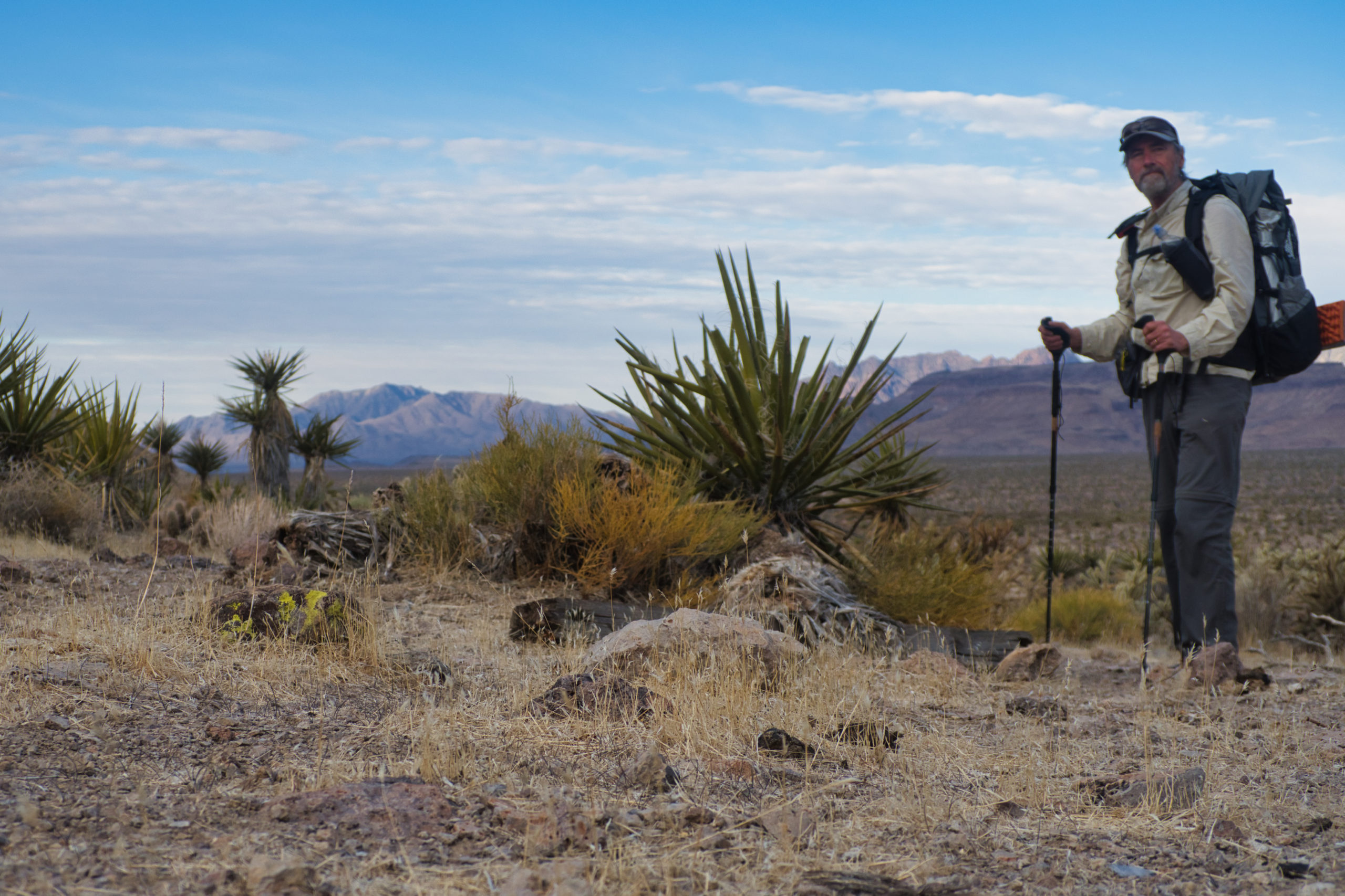
Up at first light, a light dulled by rafts of low clouds. Whether this means bad weather or cool pleasant hiking conditions or something else altogether is impossible to say. In the Mojave, in the spring, you wake up thinking it’s going to be one kind of day and then the wind shifts a few points and it is a different kind of day entirely. Still have to hike it.
I was anxious to get going because of the uncertainties in today’s route. Up to now I have been following the Desert Trail. The DT is of course not a trail at all, but a route–a way to hike through the desert that Steve Tabor and other folks at the Desert Trail Association mapped out decades ago. Although the DT has plenty of challenging stretches, you at least know that the route is doable; that it “goes”. There is little chance of following a gully or ridge and then coming to an abrupt dropoff or cliff and having to say “well, that won’t work” and having to backtrack and find another route. Steve et al have already done that.
From here to Searchlight, and then from Searchlight to Cima, I’ll be following a route of my own devising, one based on studying topo maps over the winter. Topo maps are great, but no map can tell you everything you need to know to plan a viable route. The contour lines on most maps are 40 feet. A 20-foot high cliff or dryfall that completely blocks your route just isn’t going to show up on the map.
Nor do the maps show what the footing will be like. There is a huge difference in effort (and safety) between following a ridgeline that is composed of well-compacted soil and one that is full of large, loose, crumbling rocks and boulders, all ready to roll out from under your feet. Or on to your feet.
So I am feeling nervous about today’s hike.
My plan is to cross a low saddle in the Woods Mountains, cross a valley and traverse the far more formidable Hackberry Range. And then fill up on water at Hackberry Springs on the far side of the range.
The route looked challenging but plausible. I can see cliff bands on Hackberry Mountain that make a route to the top problematic. However I am not a peak-bagger, and am planning on contouring around on the mountain’s north shoulder, then dropping down to the its main drainage valley on the east where the spring (if flowing) is located.
I have enough water to last the night if I could not make it to the springs, but only just enough. If I had to reroute I would run out of water. An early start was my way of improving my chances.
At the saddle in the Woods Mountains
The passage through the Woods Range was about what I expected–a fairly gentle climb through a low saddle and then down through a gully on the other side. Other than the usual detours to avoid catclaws choking the gully, it was pretty standard desert cross-country travel.
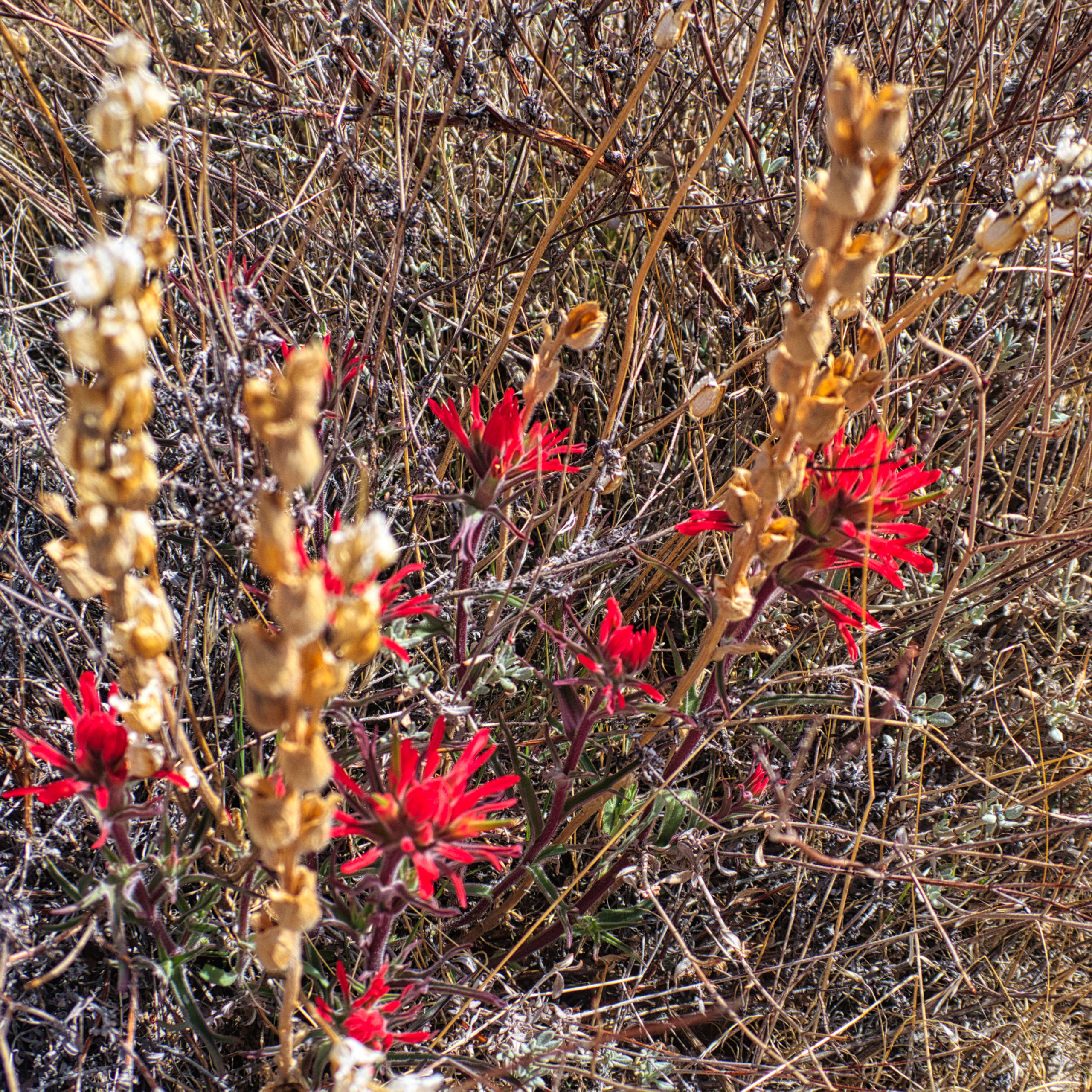
First flowers I have seen on this trip, on the west side of Hackberry Mountain
Crossing Watson Wash and the valley that separates the Woods Mountains from Hackberry Mountain was also routine, mostly a matter of slaloming through the vegetation and keeping on track toward the valley I intended to take up into Hackberry.
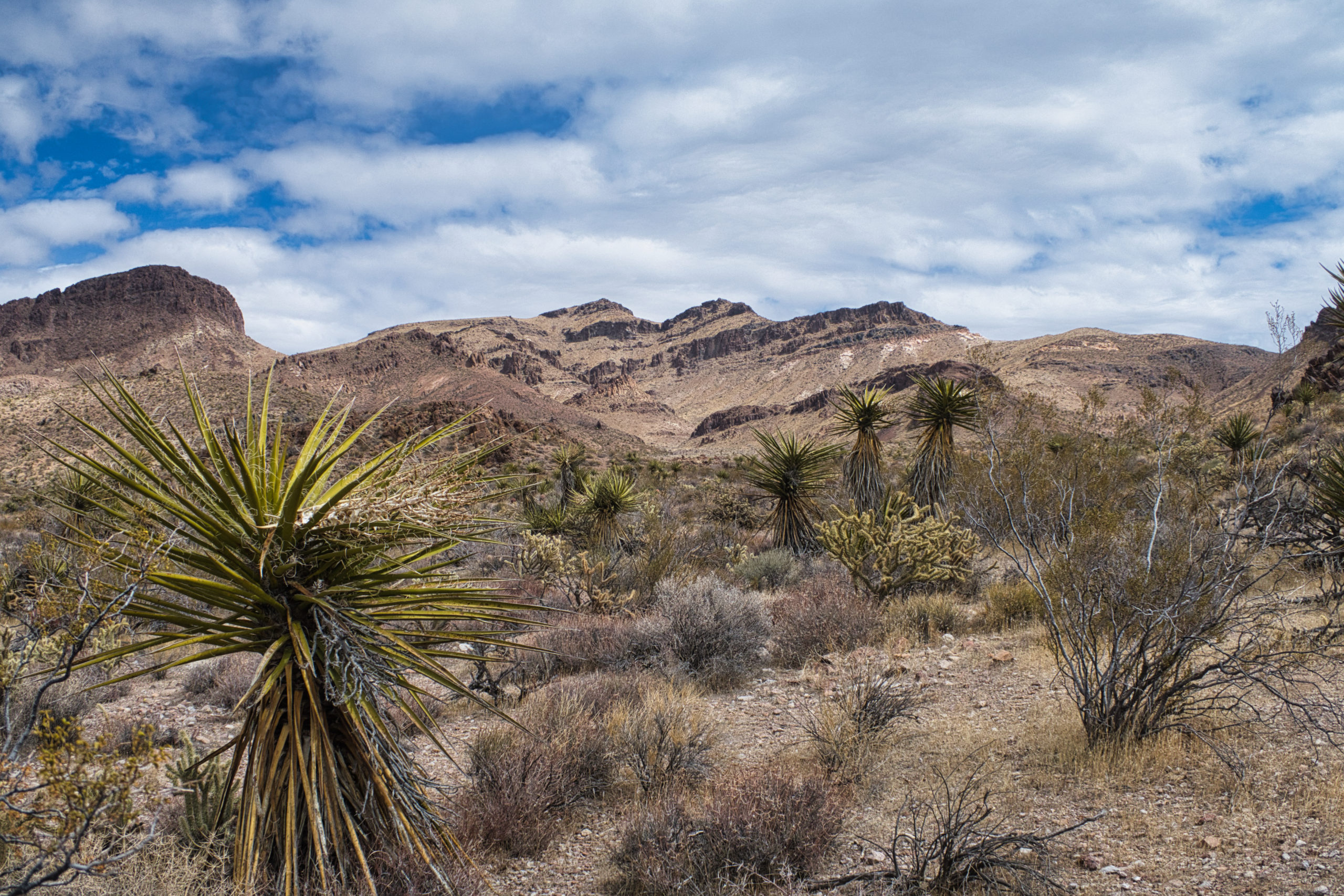
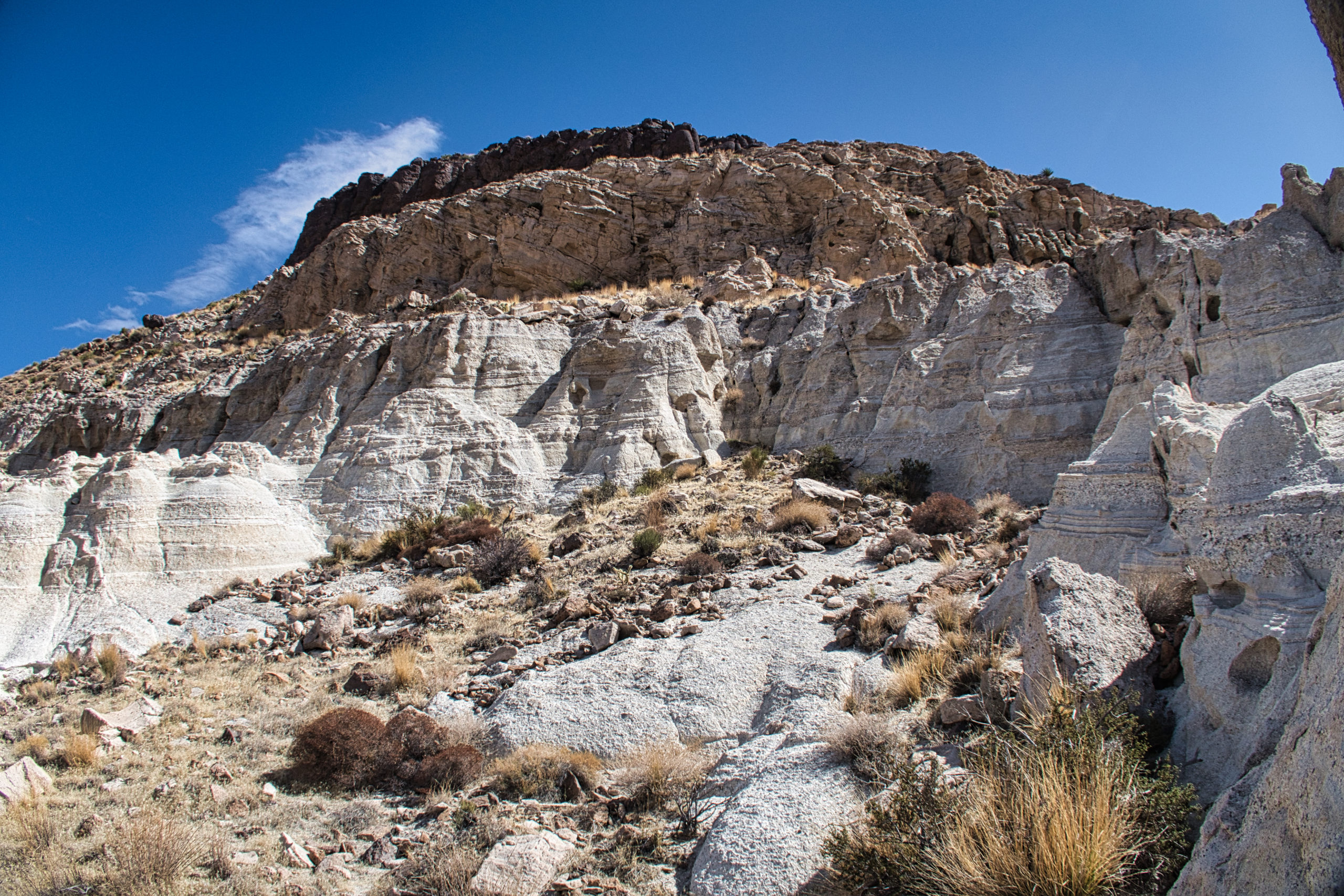
Hackberry Mountain above. My plan was to go left and avoid the cliff bands
As it turned out the route was indeed challenging but doable. Slow going for much of the day, making sure of every foothold. But doable. It mostly involved sidehilling on the rocky slopes, adjusting my altitude to avoid rocky cliffs above and below.
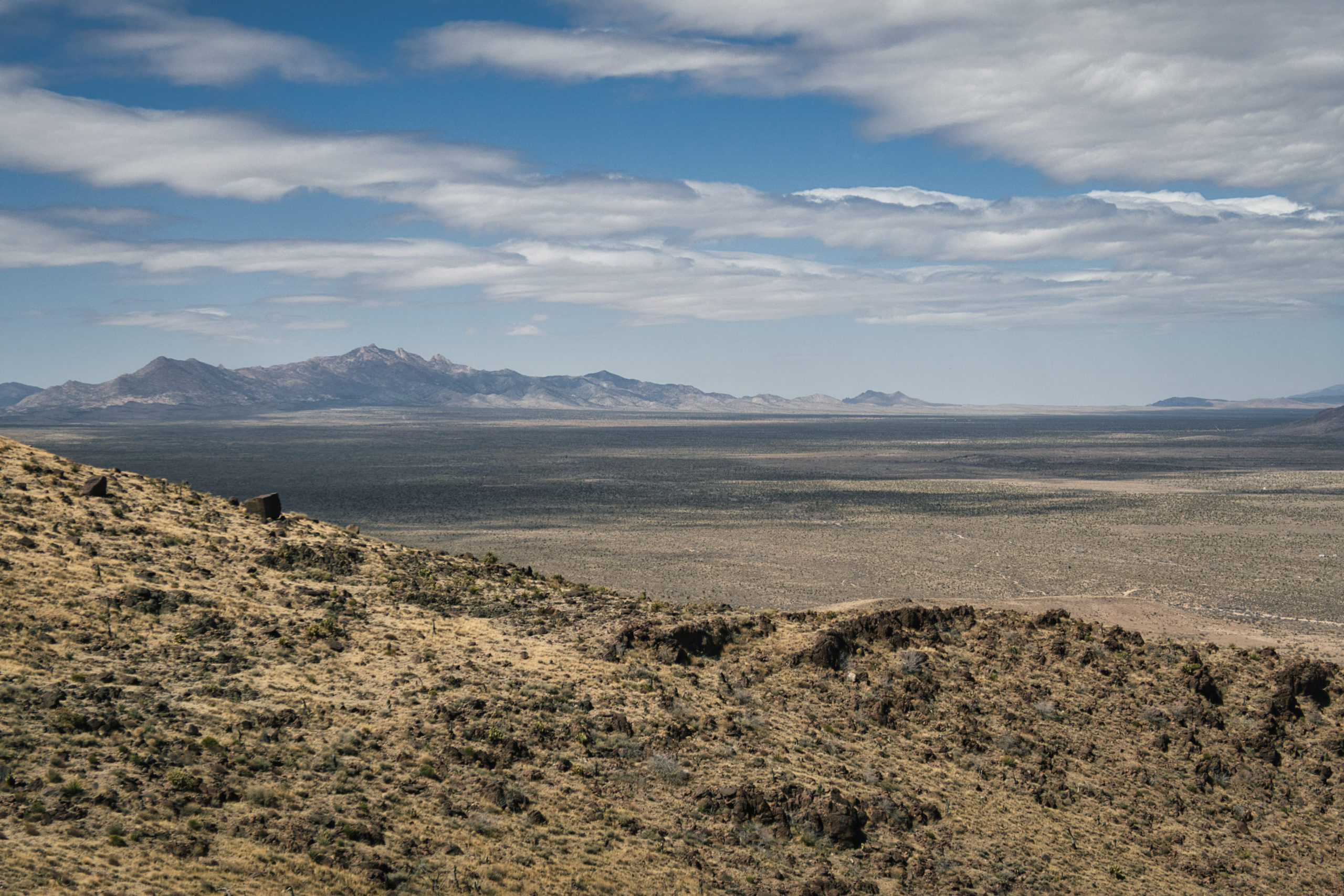
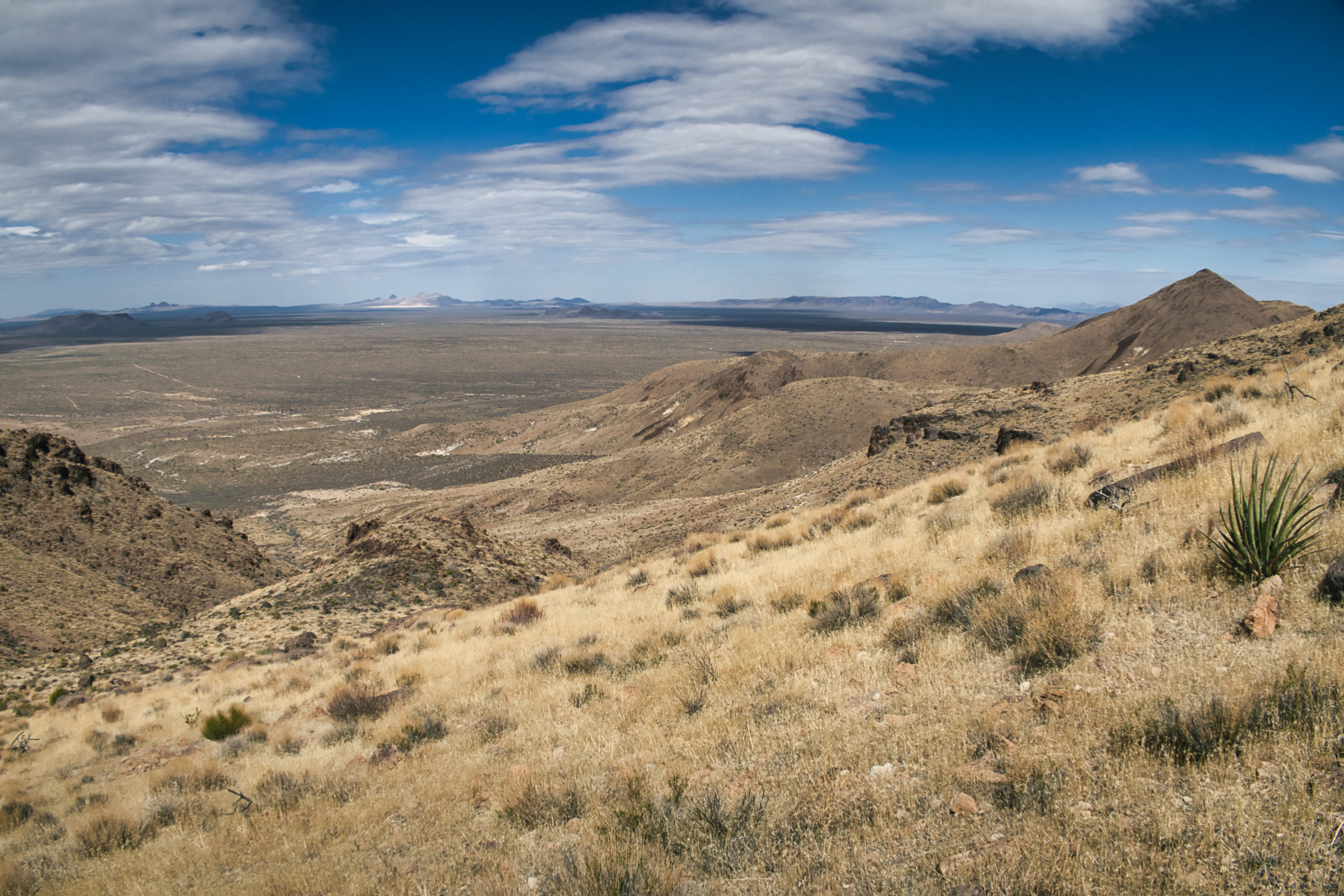
View from the north slopes of Hackberry Mountain across the Lanfair Valley and up to the New York Mountains. They will be on my return route.
The wind was as big a problem as the terrain. It rose steadily through the day, occasionally slamming me with rogue gusts as I made my way around the exposed northern slopes.
One of those gusts stole another neck cape. I lost my first one–a dedicated cape that slipped over my hat with an elastic band–in the Providence Mountains. It sailed far away into the brush and I could not find it.
I always bring a couple of bandannas and pressed one into service as a replacement, placing it under my hat and then tightening my hat down as best I could. The wind took this one too, and I was lucky to catch my hat before the desert swallowed it up as well. I was in a steep rocky gully and the wind was blowing uphill, so I was sure I could find a bright yellow bandanna there. It couldn’t have gone that far, right?
Looking up at three layers of rock on Hackberry Mountain. My bandanna is up there somewhere.
But apparently it could. I searched a good hundred yards up the gully, going up one side and down the other, but there was no bandanna to be found. I had one more bandanna but was unwilling to risk losing it, so it stayed safe in my pack, and I slathered sunscreen on my neck and ears.
As I rounded the mountain and neared the spring, some good burro trails emerged. They were well-placed and some of them looked as though they had been constructed by trail crews. “These burros are wise” I thought. “I can profit from their wisdom and just follow their fine trails to the spring. The burros will be my teachers and I will learn their lessons”.
But the trails all dissipated into nothing or ended in piles of shit. I was still on my own when it came to finding a path forward. Perhaps that was the true lesson of the burro teachers.
Eastward view of the Castle Mountains and Piute Mountains, my next mountain traverses.
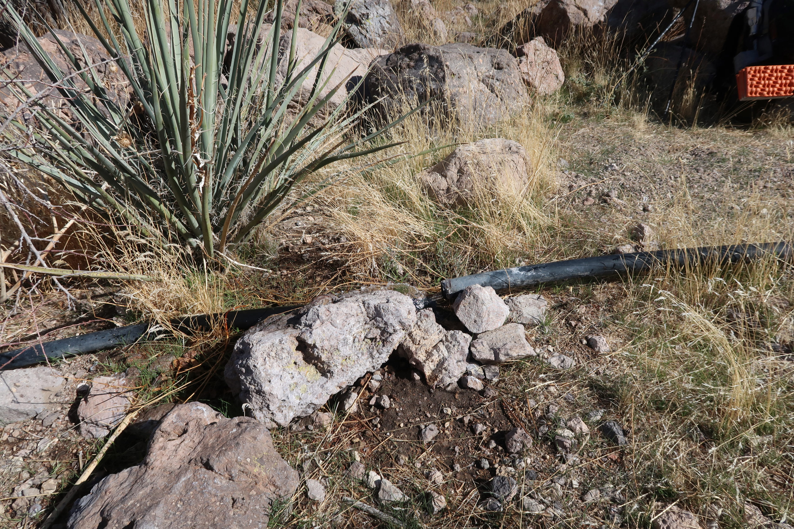
I reached the spring–or rather its location on the map–around 4PM. There were a couple of qanats (underground aqueducts dug by miners to increase water flow) but both were dry and filled with debris. There was a rusted pipe spring flowing at about one drip every 10 seconds.
But I thought I could hear the sound of water flowing somewhere below me. Following the gully down I came to a stretch of black plastic pipe, and a bit further down I found where the pipe sections had pulled apart and a steady stream of water–cool sweet water, not warm cow-shit water–was flowing out.
I took a couple of liters and headed down the jeep road that reached the spring from the Lanfair Valley road. Although it was a bit late, I figured I could make the six miles to my cache near the road before dark. I didn’t need the water in the cache, but the thought of the beer that I had also buried was a powerful motivator. I had completed a challenging traverse of two mountain ranges and a beer would be just the thing to cap off the day.
As indeed it was. Although the wind was still high, I was able to enjoy a beer with dinner (adobo mac and cheese, a favorite) in the snug confines of my tarp, a good end to a good day.
Keep the stories coming. I enjoy them.