

Two Elk Creek to Gore Creek
Big mistake last night in campsite choice. It was open and meadowy and the dew covered everything as soon as the sun set. My quilt was soaked before the stars came out.
Actually it was not the campsite choice that was bad so much as the choice not to pitch my tent. I was tired, the skies were clear and so it seemed too much trouble. I would have been glad to sleep under tree cover, but there were no flat open areas in the trees in this canyon, and so a meadow spot had to do. I did not see a better campsite until several miles on in the morning.
The Two Elks trail passes through the back bowls of Vail and I can see how they could be quite special to ski: the basin is several miles in extent, with numerous branching valleys that all converge, a mix of open and forested hills, none terribly steep. It also seems like a good wildlife area and perhaps it should have been left to the lynx and the bears.
The trail here is labeled as a National Recreation Trail on the map, whatever that means. Maybe it means there is funding to maintain the trail. It is in excellent shape. I suppose hikers and bikers could get rides on the chairlifts, but the lifts weren’t running, at least not the ones at the bottom of the valley. Maybe you just get a lift to the top of the ridge and bomb down from the high point. But no one was doing that today. There were tire tracks on the trail but no bikers, another day in which I had the trail all to myself.
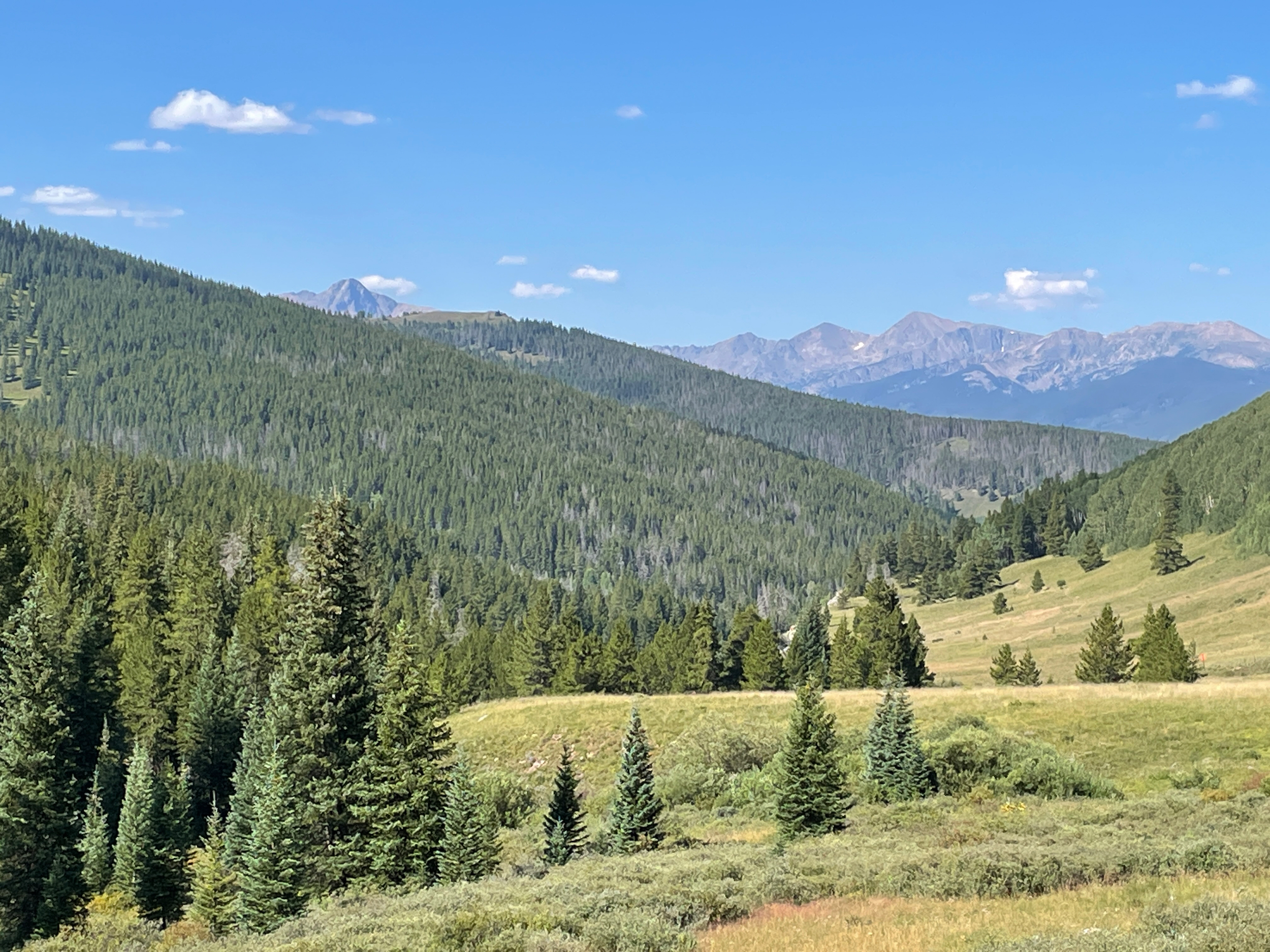
Looking back at the Holy Cross Wilderness from the upper back bowls
Reached the pass at about 11, later than I expected. The map labeled the distance as about 6 miles. My InReach registered 8 miles, which means it was more like 9 or 10 (it only takes a point every 5 minutes and so misses many of the twists and turns of the trail). This pass isn’t above treeline, so the views are not so expansive. I could see Mts Holy Cross and Jackson behind me as I climbed through the meadows though.
Once at the top there were a few views of the Gore Range through the trees, ragged and threatening as always. The drop to I-70 was steep, steep, steep. Remarkably there were MTB tracks on the trail. I would not want to push a bike up this trail and it seems suicidal to ride one down. At least for me it would be. The skill level of MTBers these days is truly remarkable.
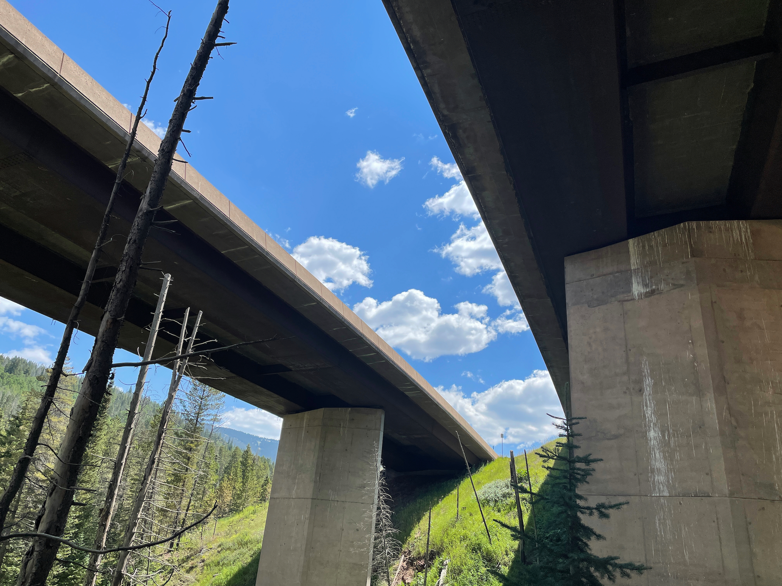
What I-70 looks like from below
After dropping 2500 feet in two miles I crossed under I-70 and met up with the paved bike trail that connects Frisco to Copper to Vail. This is my roadwalk for today, a stretch of about 3 miles down the paved bike path that is somewhat separated from the interstate. There was a fair amount of bike traffic and also a few runners. Most of the traffic was headed down from Vail Pass to Vail, but a few hardy souls (mostly older riders) were gamely chugging uphill as well.
I looped through the Gore Creek campground which I have probably passed a hundred times on the interstate. It is actually pretty nice and is far enough away from the interstate and close enough to Gore Creek that you don’t hear much traffic noise. I stopped for lunch along the creek and then headed up. This will be my last big climb–up and over Red Buffalo Pass, then down to Silverthorne.
The hike was scenic but not outstanding. Maybe I have been in the mountains too long although 10 days does not seem long enough to get tired of beautiful scenery. There were plenty of dayhikers for the first 3 miles but no backpackers. Once past the dayhikers I saw another bear, the fifth one on this trip. There were lots of ups and downs on the trail. It took a long time to make it the 5 miles to the base of the pass where I am camped.
It is a delightful camp: nice flat spots among large graceful Englemann Spruce, flowery meadows surrounding the camp, a beautiful creek nearby with a rock outcropping over it that affords sun and nice views. A good place for the last camp of the hike and I am glad to be here.