
at 38.9412, -106.4573
Took a zero yesterday at Twin Lakes. Tried fishing, but the lakes are shallow and marshy and I did not want to rent a canoe to get out to the deep water. Especially as it rained on and off all day. So I spent most of the day hanging out on the porch of the shabby hiker cabin with the various hikers heading north (CDTers) or south (CTers) who stop in at the general store for resupply or a room. Met one hiker, Matt, whom I’d hiked with for a couple of days on the PCT last year. He is hiking the CDT this year.
We are a raggedy bunch and are stared at by the auto tourists heading up to Aspen. We wave; some wave back with a big smile, others snap their heads forward, staring straight ahead and pretending they were not gawking.
Although we look like bums, we are not. At least not always. The group I dined with last night included an Iranian political refugee; a gym owner from Dallas working on a Masters in nutrition and experimenting on himself as part of his thesis project (he explained this to us over a heap of fried potato slices slathered with Velveeta); an aspiring actor from Houston; and an Air Force systems analyst. It’s hard to imagine any other circumstances that would throw such a group together. The talk ranged from the ridiculous (what type of bottle works best when you don’t want to leave your tent at night to pee) to the truly horrific (having one’s family arrested and summarily executed).
The CT splits at Twin Lakes into eastern and western routes through the Collegiate Range, rejoining some 80 miles away, south of Monarch Pass. The eastern route is about a thousand feet lower on average than the western, and mostly forested. The western route is largely above treeline and more closely follows the continental divide. I’ve hiked the eastern route already and so am taking the western, despite the sketchy weather. Most of my fellow hikers are going east; I hope to see them again further down the trail.
I leave under cloudy skies which soon produce a steady drizzle all the way up to Hope Pass, some 8 miles and 3200 feet above Twin Lakes. Although the weather is soggy, there is no thunder, which would be much more of a problem on the exposed trail.
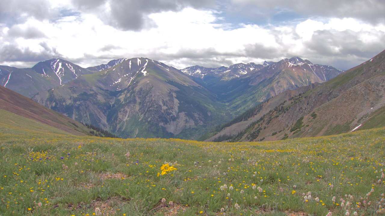
14ers beckon from Hope Pass
As fast as the trail ascended, it descends some 2500 feet to the headwaters of Clear Creek and the ghost town of Winfield. The skies clear for a bit and I pause to watch woodpeckers, beavers and deer go about their business.
I had hoped to make Lake Ann, but it is another 800 foot climb, the clouds are closing in again and I’m tired. I got my tarp pitched just as the rain started again, a real thunderstorm this time. But I’m warm and dry, sipping whisky and enjoying the Peruvian chocolate that Cathy slipped into my resupply box. All is good.